The NOAA marine forecast Destin is the official weather prediction issued by the National Weather Service for Destin’s coastal and offshore waters. It provides real-time information about wind speeds, wave heights, sea conditions, visibility, and any small craft advisories currently in effect. Whether you’re heading out on a pontoon boat, jet ski, fishing charter, or yacht rental in Destin, this forecast serves as your most reliable tool for planning safe trips on the water.
This guide walks you through everything you need about reading and using the Destin marine forecast. You’ll learn where to find official NOAA updates, how to interpret wind and wave data, what key weather terms mean for your safety, and how to make smart decisions before leaving the dock. By the end, you’ll check current conditions and plan your water time with complete confidence.
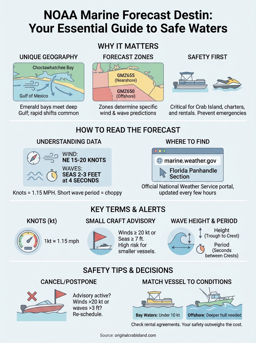
Why the NOAA marine forecast matters in Destin
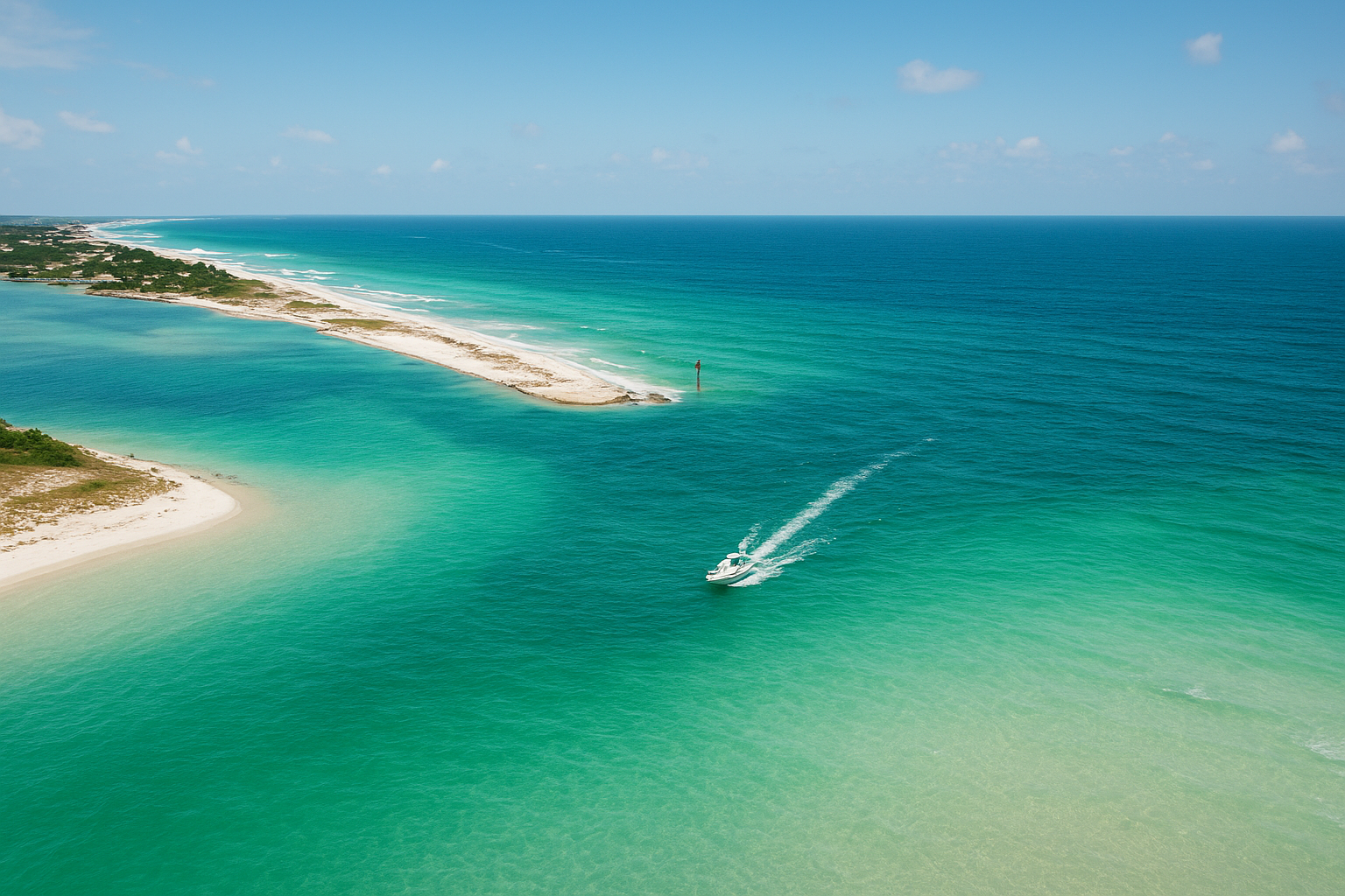
Destin’s waters sit at the junction where shallow emerald bays meet the deep Gulf of Mexico, creating conditions that can shift rapidly throughout the day. The NOAA marine forecast Destin tracks these changes hour by hour, giving you critical information before you head to Crab Island, launch a fishing charter, or rent a jet ski. Weather patterns that look calm from shore often hide building winds or rising seas that make open water dangerous for small craft.
Destin’s unique coastal geography

Your safety depends on understanding how Destin’s geography affects marine conditions. The narrow East Pass connects Choctawhatchee Bay to the Gulf, funneling currents and waves that can surprise inexperienced boaters. Beyond the pass, offshore waters behave differently than protected bay areas, with wave heights and wind speeds that vary based on distance from shore. The forecast breaks down these zones clearly, telling you exactly what to expect in each area.
The difference between a 1-foot wave inside the bay and a 4-foot wave 20 miles offshore can mean everything for your boat’s handling and your comfort.
Checking the official forecast prevents wasted rental time, cancelled trips, and potential emergencies on the water.
How to read and use the Destin marine forecast
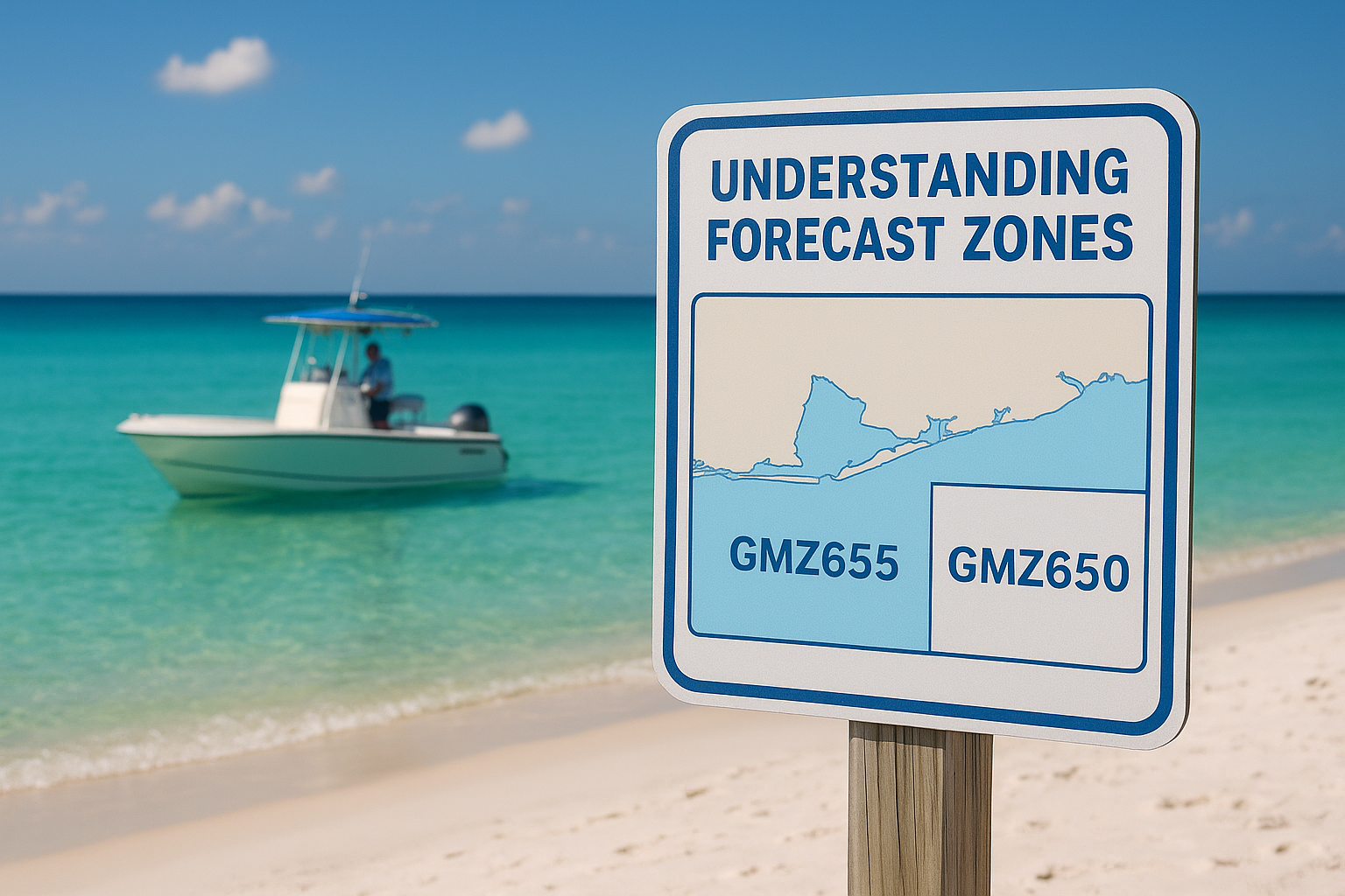
The NOAA marine forecast Destin uses a straightforward format that divides water areas into specific zones and provides time-stamped predictions for each. You’ll find forecasts organized by zone codes like GMZ655 (coastal waters out to 20 nautical miles) and GMZ650 (waters 20 to 60 nautical miles offshore), with separate entries for Choctawhatchee Bay and other protected areas. Each forecast includes wind direction and speed, wave heights, sea state descriptions, and any active advisories that affect your zone.
Understanding forecast zones
Zone boundaries determine which forecast applies to your planned route. GMZ655 covers the area most Destin boaters use for Crab Island trips, nearshore fishing, and jet ski rentals, extending from the beach out to 20 nautical miles into the Gulf. Beyond that distance, GMZ650 takes over with conditions that typically show higher waves and stronger winds. Protected bay waters fall under different zone codes with calmer predictions since barrier islands and land masses block open Gulf swells.
Your rental boat’s capabilities and your experience level should match the zone you’re entering, not just the weather at the dock.
Reading wind and wave data
Wind information appears as direction plus speed, listed in knots rather than miles per hour (one knot equals about 1.15 mph). A forecast reading "Northeast winds 15 to 20 knots" tells you both where wind comes from and its strength. Wave heights follow the same pattern, showing average height plus period (the time between waves), like "Seas 2 to 3 feet at 4 seconds." Higher wave periods mean longer, smoother swells, while short periods create choppy, uncomfortable conditions even at lower heights.
Where to find the official Destin forecast online
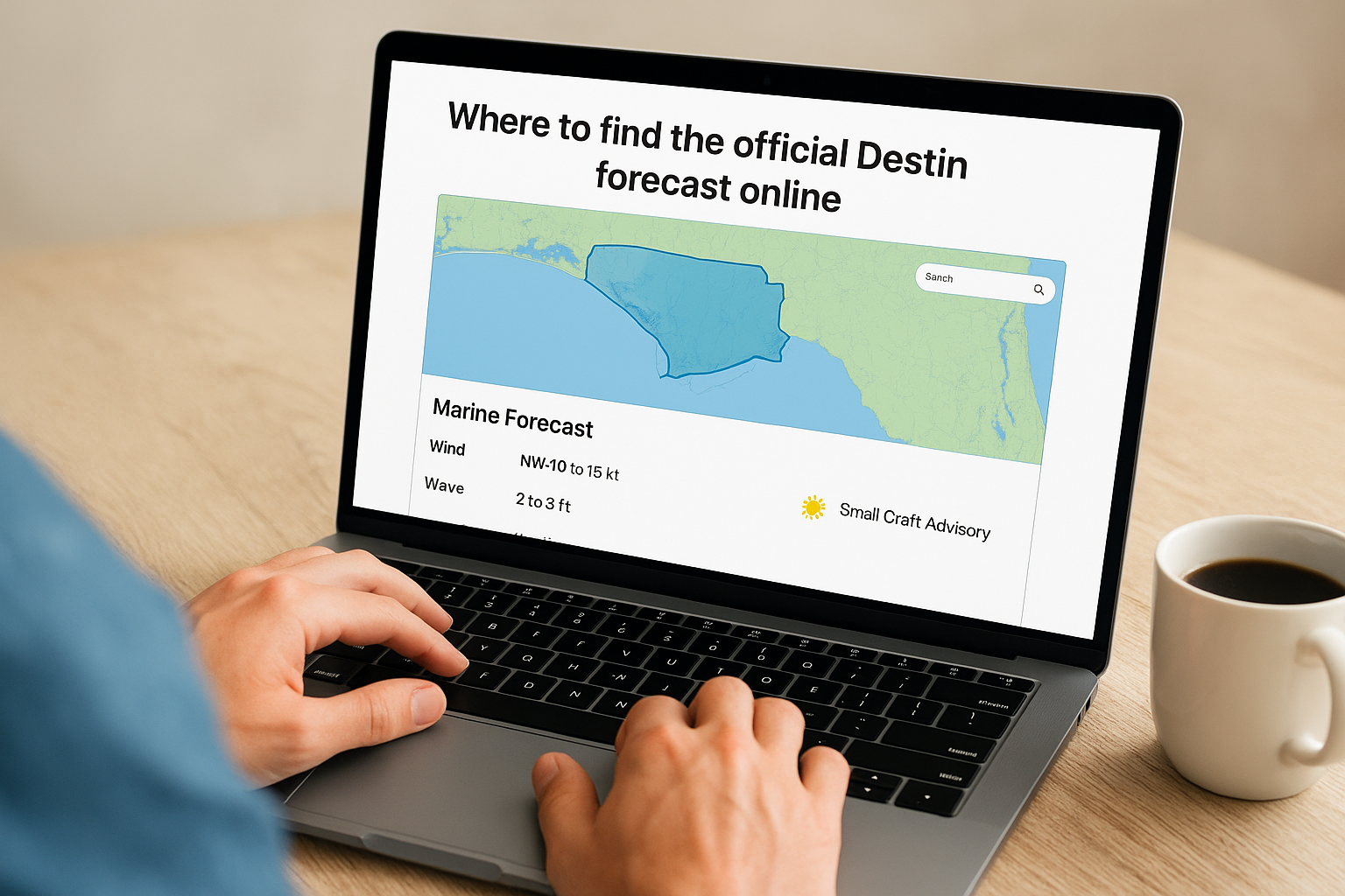
The most reliable source for the NOAA marine forecast Destin is the National Weather Service’s official marine portal at marine.weather.gov. This site updates every few hours with the latest conditions, predictions, and advisories specific to Destin’s coastal zones. You can access zone-specific forecasts by clicking on the water areas shown on the interactive map or by entering zone codes like GMZ655 directly into the search function.
Accessing your zone forecast directly
Navigate to marine.weather.gov and locate the Florida Panhandle section on the map, then click the waters off Destin to pull up current conditions. The forecast page displays wind speeds, wave heights, weather descriptions, and any small craft advisories in effect for the next 48 to 72 hours. You’ll also find links to nearby buoy data, radar images, and extended offshore predictions that help you plan multi-day trips.
Bookmark your specific zone forecast page before your Destin vacation so you can check conditions quickly each morning without searching.
Key wind, wave, and weather terms explained
Understanding the technical language in the NOAA marine forecast Destin helps you translate predictions into real conditions on the water. Terms like knots, small craft advisory, and wave period carry specific meanings that directly affect your boating decisions. Learning these definitions takes only minutes but gives you the knowledge to interpret forecasts accurately and avoid dangerous situations before they develop.
Knots vs. miles per hour
Wind speed appears in knots throughout marine forecasts, not the miles per hour you see in land weather reports. One knot equals 1.15 miles per hour, so 10 knots converts to roughly 11.5 mph. This difference matters when you’re comparing what you feel on shore to what the forecast predicts on open water. A 20-knot wind (23 mph) feels strong enough to create whitecaps and make small boat handling difficult, while a 5-knot breeze (6 mph) barely ripples the surface.
Small craft advisory thresholds
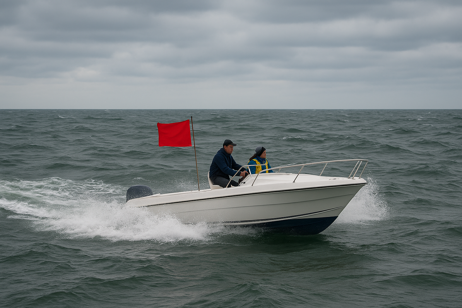
The National Weather Service issues a small craft advisory when sustained winds reach 20 to 33 knots or seas build to 7 feet or higher. These thresholds signal conditions where inexperienced operators or smaller vessels face significant risk. Advisories remain voluntary warnings rather than legal restrictions, but ignoring them puts you and your passengers in potential danger.
Small craft advisories account for most preventable boating accidents in the Gulf, yet many renters skip checking active warnings before departure.
Wave height and period
Wave height measures the vertical distance from trough to crest in feet, while wave period counts seconds between successive crests. Short periods (2 to 3 seconds) create choppy, uncomfortable rides that splash water into boats and tire passengers quickly. Longer periods (5+ seconds) produce rolling swells that boats handle more smoothly even at similar heights.
Destin boating safety tips based on the forecast
The NOAA marine forecast Destin becomes actionable only when you translate predictions into concrete safety decisions before leaving the dock. Reading wind speeds and wave heights means nothing if you don’t adjust your plans accordingly. Smart boaters check conditions every morning, compare forecasts against their vessel’s capabilities, and make tough calls about canceling or rescheduling trips when conditions exceed safe limits.
Cancel or postpone when advisories are active
Small craft advisories signal that conditions threaten smaller vessels, pontoon boats, jet skis, and inexperienced operators. These warnings exist to prevent accidents, not to ruin your vacation plans. Sustained winds above 20 knots or waves exceeding 3 feet create rough seas that challenge boat handling, increase seasickness, and make emergencies harder to manage. Rental companies often restrict departures during active advisories, but you should make that call yourself based on the forecast rather than waiting for someone else to stop you.
Your safety outweighs the cost of a rescheduled rental, and most Destin operators work with customers when weather forces cancellations.
Match your vessel to forecasted conditions
Different boats handle marine conditions differently. Pontoon boats perform best in calm bay waters with winds under 10 knots, while deeper-hull fishing charters tolerate rougher offshore seas. Check your rental agreement’s weather restrictions and compare them against forecast zones. A forecast calling for 2-foot waves inside GMZ655 might mean comfortable conditions for larger vessels but choppy, wet rides for jet skis and smaller craft.
Ready to check the forecast
Checking the NOAA marine forecast Destin before every water trip protects your safety and maximizes your time on the Gulf. The information you’ve learned here gives you the tools to read conditions accurately, understand advisory warnings, and make smart decisions about when to launch. Your next Destin adventure starts with confident planning. Book your pontoon rental, jet ski, or fishing charter with Original Crab Island and combine professional equipment with the forecast knowledge that keeps you safe on the water. For more options, explore our Pontoon rentals page. For more options, explore our Destin fishing page. For more options, explore our our rentals página.
Popular Crab Island Pages
- Alquiler de pontones en Crab Island
- Chárters de pesca en Crab Island
- Crab Island Boat and Yacht Rentals
- Parapente acuático en Crab Island
- Alquiler de motos acuáticas en Crab Island
- Crab Island Helicopter Rides
- Crab Island Snorkeling Tours
- Crab Island Paddleboard Rentals
- Crab Island Kayak Rentals
- Alquiler de bicicletas en Crab Island
- Crab Island Shark Boat
- Crab Island Pirate Ship
- Crab Island Tiki Rentals
- Crab Island Snorkeling Tours